Woke up to rain this morning, but I was warm and dry in my tent. I put off writing until way too late, and now I’m real tired, so this will be short.
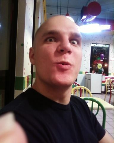
Independence is small. We picked up our food box and got a hitch to Lone Pine, which is bigger, to pick up a package Tom had sent there. There is a McDonald’s. I ate five double cheeseburgers and three McCheeses. And a McFlurry.
My beard is a force to be reckoned with.
We’re staying at the Something Villa Whatever Hotel. It’s cheap and the shower is down the hall, so I walked around in a towel. No one could hear anything over the collective sighs of all the ladies that were just swooning all over the place. It’s like, hey, control yourselves, right?
It’s so late at night! I usually go to sleep at, like, nine.
We’ve crossed the highest elevation on the trail, Forrester Pass. There’ll be hard times ahead, but I know we can do this. Just one foot in front of the other. Good night!
Tuesday, September 1, 2009

Monday, June 15—Day 54
Big, big day today. We woke up at four (!) to get to Forrester Pass as early as possible. First, though, we ran into some problems.
We have been very fortunate on this adventure in that nearly every creek, stream, or river we had to cross was well bridged in some way. Today, however, we met our match in Tyndall Creek, a wide body of fast flowing water. The few rocks that sat in the creek were icy and dangerous, and left gaps too large to jump anyway. After searching up and downstream, it was clear that we’d have to ford it. I took off my boots and socks, rolled up my pant legs, and stepped in. The water was icy cold, and my feet were almost numb by the time I made it to the other side. If the Sierras are this cold in mid-June, I don’t want to think about what winter must be like up here.
We made it to the base of Forrester Pass by nine. The trail had been partially obscured by snow, and sets of footprints left by other hikers led straight up the slope. We followed them with difficulty, picking up the switchbacks of the trail where they weren’t covered, and scrambled up sections of loose, rocky mountainside. It was a dangerous climb.
When we finally made it to the top, we congratulated ourselves briefly before looking down the other side. There was snow everywhere, and the trail was nowhere to be seen. We picked a set of footprints that ran to the left and followed them carefully down the slope. By now, the sun had softened the snow, and I stepped through a few times, sinking down to my hips. After a few slips and some close calls, we made it down to the bottom, and headed to the treeline for lunch. My boots and socks were (are) completely soaked, and the sun had disappeared behind heavy clouds, taking with it any chance of drying them. I sloshed for four miles before the trail took an upward turn.
We had mistakenly (stupidly) been under the impression that, from Forrester, it would be a downhill to where we split off to enter Independence. This was way wrong. In order to get to Independence, we’d have to cross Kearsarge Pass, another two-or-three thousand foot climb. Since we had no choice, we climbed up to our second pass of the day. Halfway up, I was totally exhausted. I shuffled up the slope at glacial speed, 100 steps at a time. Between breaks to lean on my poles, catch my breath, and wonder how I would ever get through the rest of the Sierras. At one point, I got so hungry that I ate a bag of couscous without cooking it, just poured the dry pasta in my mouth. It was very crunchy.
I did make it to the top eventually, and after a short break, we started the descent down the other side, ending four miles later in a parking lot, where a guy named Rick gave us a ride into town.
We are in Independence. The thing I’m most excited about is that, for the first time in two weeks, I have phone service. I’m gonna call the hell out of people! Tomorrow. ‘Night.
We have been very fortunate on this adventure in that nearly every creek, stream, or river we had to cross was well bridged in some way. Today, however, we met our match in Tyndall Creek, a wide body of fast flowing water. The few rocks that sat in the creek were icy and dangerous, and left gaps too large to jump anyway. After searching up and downstream, it was clear that we’d have to ford it. I took off my boots and socks, rolled up my pant legs, and stepped in. The water was icy cold, and my feet were almost numb by the time I made it to the other side. If the Sierras are this cold in mid-June, I don’t want to think about what winter must be like up here.
We made it to the base of Forrester Pass by nine. The trail had been partially obscured by snow, and sets of footprints left by other hikers led straight up the slope. We followed them with difficulty, picking up the switchbacks of the trail where they weren’t covered, and scrambled up sections of loose, rocky mountainside. It was a dangerous climb.
When we finally made it to the top, we congratulated ourselves briefly before looking down the other side. There was snow everywhere, and the trail was nowhere to be seen. We picked a set of footprints that ran to the left and followed them carefully down the slope. By now, the sun had softened the snow, and I stepped through a few times, sinking down to my hips. After a few slips and some close calls, we made it down to the bottom, and headed to the treeline for lunch. My boots and socks were (are) completely soaked, and the sun had disappeared behind heavy clouds, taking with it any chance of drying them. I sloshed for four miles before the trail took an upward turn.
We had mistakenly (stupidly) been under the impression that, from Forrester, it would be a downhill to where we split off to enter Independence. This was way wrong. In order to get to Independence, we’d have to cross Kearsarge Pass, another two-or-three thousand foot climb. Since we had no choice, we climbed up to our second pass of the day. Halfway up, I was totally exhausted. I shuffled up the slope at glacial speed, 100 steps at a time. Between breaks to lean on my poles, catch my breath, and wonder how I would ever get through the rest of the Sierras. At one point, I got so hungry that I ate a bag of couscous without cooking it, just poured the dry pasta in my mouth. It was very crunchy.
I did make it to the top eventually, and after a short break, we started the descent down the other side, ending four miles later in a parking lot, where a guy named Rick gave us a ride into town.
We are in Independence. The thing I’m most excited about is that, for the first time in two weeks, I have phone service. I’m gonna call the hell out of people! Tomorrow. ‘Night.
Sunday, June 14—Day 53
The Green Shark has a malfunctioning zipper, and I could not be more annoyed about it.
We climbed Mt. Whitney, as promised. It was a tough four miles or so up snowy switchbacks, the air too thin for normal breathing. We climbed for four or five hours before finally reaching the top. It was very cold up there! The bite valve on my hydration tube kept freezing, and I would have to chew on it to crush the ice crystals blocking the tube to get water. At the top of the mountain, there is a stone cabin, a shelter for anyone who climbs up. I did not go inside, choosing instead to check out the view, which was beyond description. Snowy mountains on all sides bowed down below us. We were kings.
I had a cell phone signal for the first time in nearly two weeks, and managed to make two quick calls before it was time to go. I wish I could have stayed up there longer, despite the freezing cold, but we were in a hurry.
The climb down went very quickly. Almost too quickly, once or twice. The snow was softening as noon approached, and my feet slid around on the drifts. My trekking poles saved me more than once, and I can’t believe I haven’t broken them yet. Near the bottom, the footsteps of previous hikers led us down a steep snowy slope. Instead of creeping carefully down the hills, I ran at full force. The air at the bottom was warm, and when I finally stopped, I took off my jacket and stood in the sun. I have learned to appreciate warmth.
Tomorrow we’re going to climb Forrester Pass, which is at something like 13,000 feet. It’s going to be another big day. ‘Night.
We climbed Mt. Whitney, as promised. It was a tough four miles or so up snowy switchbacks, the air too thin for normal breathing. We climbed for four or five hours before finally reaching the top. It was very cold up there! The bite valve on my hydration tube kept freezing, and I would have to chew on it to crush the ice crystals blocking the tube to get water. At the top of the mountain, there is a stone cabin, a shelter for anyone who climbs up. I did not go inside, choosing instead to check out the view, which was beyond description. Snowy mountains on all sides bowed down below us. We were kings.
I had a cell phone signal for the first time in nearly two weeks, and managed to make two quick calls before it was time to go. I wish I could have stayed up there longer, despite the freezing cold, but we were in a hurry.
The climb down went very quickly. Almost too quickly, once or twice. The snow was softening as noon approached, and my feet slid around on the drifts. My trekking poles saved me more than once, and I can’t believe I haven’t broken them yet. Near the bottom, the footsteps of previous hikers led us down a steep snowy slope. Instead of creeping carefully down the hills, I ran at full force. The air at the bottom was warm, and when I finally stopped, I took off my jacket and stood in the sun. I have learned to appreciate warmth.
Tomorrow we’re going to climb Forrester Pass, which is at something like 13,000 feet. It’s going to be another big day. ‘Night.
Saturday, June 13—Day 52
Didn’t sleep so well last night, despite camping early. The wind picked up at night and made the walls of my tent flap back and forth. This is not unusual, but the sound was similar to that of footsteps crunching on the pinecones and needles around my tent. I kept expecting to see lumbering shadows cast on my rain fly, or a large, furry head pop up under my vestibule to grab my pack in its teeth. I call this “Bearanoia.”
We made it through the night un-beared and left camp at 6:30 am to put in some tough miles. I’m not great at climbing, to be honest, and climbing past 10,000 feet seems much harder. It’s worth noting that Jerry, who hikes normally at a slower pace, is way better at uphill stuff than me. To this end, on bigger climbs I usually fall back and shuffle uphill like an old man, meeting Tom and Jerry at the top. When it comes to downhill or level ground, or even slightly uphill hiking, I am like lightning, though. Rest assured.
We made it to Crabtree Meadow, a gorgeous field of grass with a river flowing through and snow-capped mountains in the distance. One of those mountains is Mt. Whitney, which I’m told is the tallest mountain in the contiguous United States. We’re going to climb it tomorrow. It’s not part of the trail, but we’re here, and close as we’ll ever be.
We parted ways with Steve, who is not climbing Whitney, and set off on the trail to Guitar Lake, which lies at the base of the mountain. We set up camp 2 miles short in a rocky field, made dinner down by the river that runs alongside the trail (I can hear the water pounding) and set our bear canisters some distance away from our tents. Tomorrow is going to be a big day. Goodnight.
We made it through the night un-beared and left camp at 6:30 am to put in some tough miles. I’m not great at climbing, to be honest, and climbing past 10,000 feet seems much harder. It’s worth noting that Jerry, who hikes normally at a slower pace, is way better at uphill stuff than me. To this end, on bigger climbs I usually fall back and shuffle uphill like an old man, meeting Tom and Jerry at the top. When it comes to downhill or level ground, or even slightly uphill hiking, I am like lightning, though. Rest assured.
We made it to Crabtree Meadow, a gorgeous field of grass with a river flowing through and snow-capped mountains in the distance. One of those mountains is Mt. Whitney, which I’m told is the tallest mountain in the contiguous United States. We’re going to climb it tomorrow. It’s not part of the trail, but we’re here, and close as we’ll ever be.
We parted ways with Steve, who is not climbing Whitney, and set off on the trail to Guitar Lake, which lies at the base of the mountain. We set up camp 2 miles short in a rocky field, made dinner down by the river that runs alongside the trail (I can hear the water pounding) and set our bear canisters some distance away from our tents. Tomorrow is going to be a big day. Goodnight.
Friday, June 12—Day 51
11,000 feet, and it is getting cold! The mosquitoes, at least, were not an issue today.
Here is a problem: when I’m not hiking, the wind makes me very cold. In the morning, and at every break, I am freezing. So, I put on extra layers. Problem solved! But, once I start hiking, I become warm. Now, I’m wearing extra layers, and I can either stop to take them off, and maybe put them on again in five minutes if the sun goes behind clouds and the wind picks up, or I can just hike with them on. Today, I hiked for too long with them on, and now most of my clothes are damp with sweat at the end of the day. I’ve got them in the foot of my sleeping bag to dry out, or at least keep warm through the night, and now I have nothing to use for a pillow. Lame.
Haven’t seen any bears, but we’ve started cooking away from camp and leaving our bear canisters far away, as well as our garbage and anything that smells. The Sierras are beautiful, but camping in bear country is a pain.
When I get home, after I finish this thing, I’m gonna eat a big bowl of cereal with milk and toast with butter and jam while I sit on my couch and watch cartoons. Then I might take a nap. G’Night.
Here is a problem: when I’m not hiking, the wind makes me very cold. In the morning, and at every break, I am freezing. So, I put on extra layers. Problem solved! But, once I start hiking, I become warm. Now, I’m wearing extra layers, and I can either stop to take them off, and maybe put them on again in five minutes if the sun goes behind clouds and the wind picks up, or I can just hike with them on. Today, I hiked for too long with them on, and now most of my clothes are damp with sweat at the end of the day. I’ve got them in the foot of my sleeping bag to dry out, or at least keep warm through the night, and now I have nothing to use for a pillow. Lame.
Haven’t seen any bears, but we’ve started cooking away from camp and leaving our bear canisters far away, as well as our garbage and anything that smells. The Sierras are beautiful, but camping in bear country is a pain.
When I get home, after I finish this thing, I’m gonna eat a big bowl of cereal with milk and toast with butter and jam while I sit on my couch and watch cartoons. Then I might take a nap. G’Night.
Thursday, June 11—Day 50
Today’s hike took us through many grassy meadows. Small creeks and streams ran everywhere, and we could see snow-capped mountains in the distance. We climbed to 10,500 feet, our highest elevation yet. The next four days or so will make that seem like nothing, though.
The Sierras are full of trade-offs. We no longer have the heat of the desert, but it could snow, rain, or hail at any time. There are no more rattlesnakes, but we are in bear country, and must be very careful. The scenery is beautiful, but the elevations are high and the air is thinner, which makes climbing harder. There’s water all over the place, but there are also mosquitoes.
The mosquitoes. I sat, cooking dinner and watching ten, twenty, thirty of them float erratically around me. I don’t know what compels all insects to try and get into my ears, but I’m sick of it. There’s nothing in there for you! I slapped my shoulder at one point and killed three of them. A triple KO! Steve says that they’re going to be much, much worse. I am concerned.
On the bear front, we did pick up our bear canisters in Kennedy Meadows. All of my food, or as much as I could fit, is now in a giant, bear-proof plastic container. The rest is hanging in a tree, and I solemnly hope that no bears get it down, because I’ve got snacks in there.
We’re camped in Death Canyon. I don’t know why it’s called that. My ice axe is in my tent. G’Night.
The Sierras are full of trade-offs. We no longer have the heat of the desert, but it could snow, rain, or hail at any time. There are no more rattlesnakes, but we are in bear country, and must be very careful. The scenery is beautiful, but the elevations are high and the air is thinner, which makes climbing harder. There’s water all over the place, but there are also mosquitoes.
The mosquitoes. I sat, cooking dinner and watching ten, twenty, thirty of them float erratically around me. I don’t know what compels all insects to try and get into my ears, but I’m sick of it. There’s nothing in there for you! I slapped my shoulder at one point and killed three of them. A triple KO! Steve says that they’re going to be much, much worse. I am concerned.
On the bear front, we did pick up our bear canisters in Kennedy Meadows. All of my food, or as much as I could fit, is now in a giant, bear-proof plastic container. The rest is hanging in a tree, and I solemnly hope that no bears get it down, because I’ve got snacks in there.
We’re camped in Death Canyon. I don’t know why it’s called that. My ice axe is in my tent. G’Night.
Wednesday, June 10—Day 49
We are in the Sierras. The Sierras!
Packed up, had lunch, whatever. We didn’t get out of Kennedy Meadows until mid-to-late afternoon. We met back up with Steve, who’d spent the last two days in town with his family, and hit the trail. Right away, the difference in environment was apparent.
We walked up a grassy hill, turned a corner, and before us was a grove of pine trees. The ground was covered with tiny purple-pink flowers, so small and numerous that they seemed to form a thick haze. Every mile is more beautiful than the last. Can’t wait to see what tomorrow brings. ‘Night.
Packed up, had lunch, whatever. We didn’t get out of Kennedy Meadows until mid-to-late afternoon. We met back up with Steve, who’d spent the last two days in town with his family, and hit the trail. Right away, the difference in environment was apparent.
We walked up a grassy hill, turned a corner, and before us was a grove of pine trees. The ground was covered with tiny purple-pink flowers, so small and numerous that they seemed to form a thick haze. Every mile is more beautiful than the last. Can’t wait to see what tomorrow brings. ‘Night.
Subscribe to:
Posts (Atom)